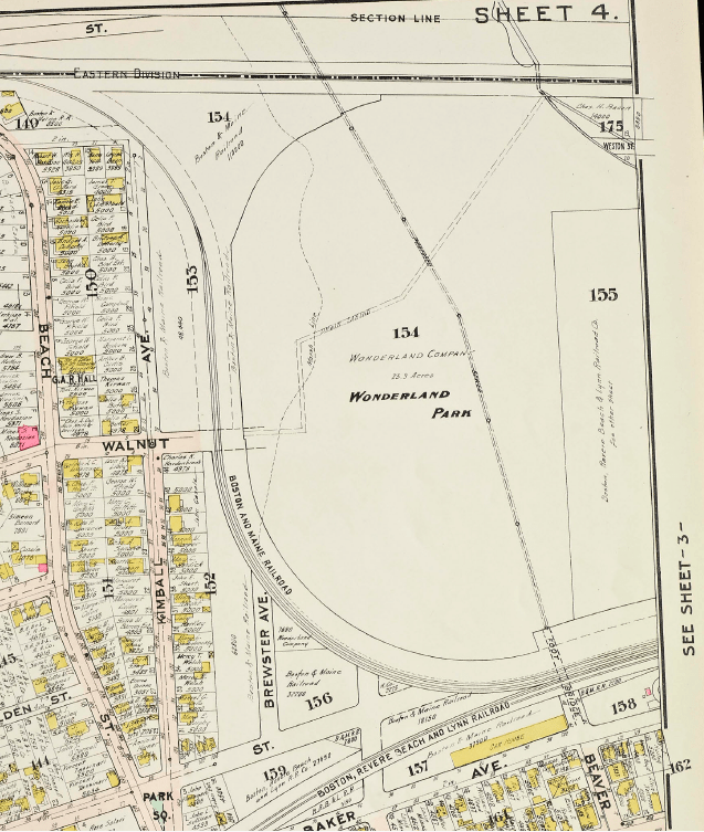
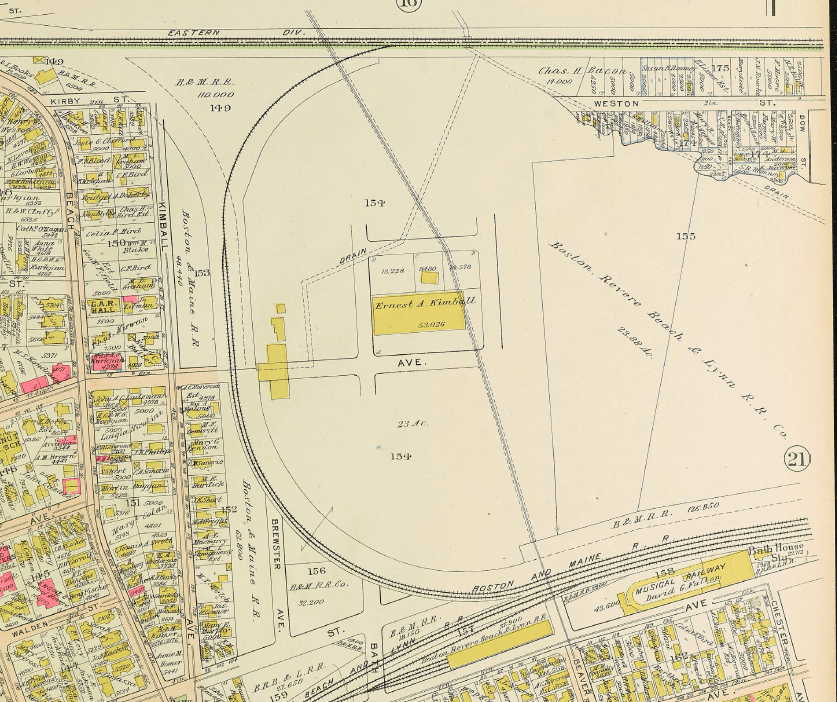
This map shows the section of Revere where Wonderland was built as it was originally laid out. None of these streets in the space between the train tracks — Brewster, Bath, Badger, Beaver, Hanover — were ever built (although the parts of Brewster, Bath, and Beaver outside the train tracks were built)
(Note — North is at the top of this image)
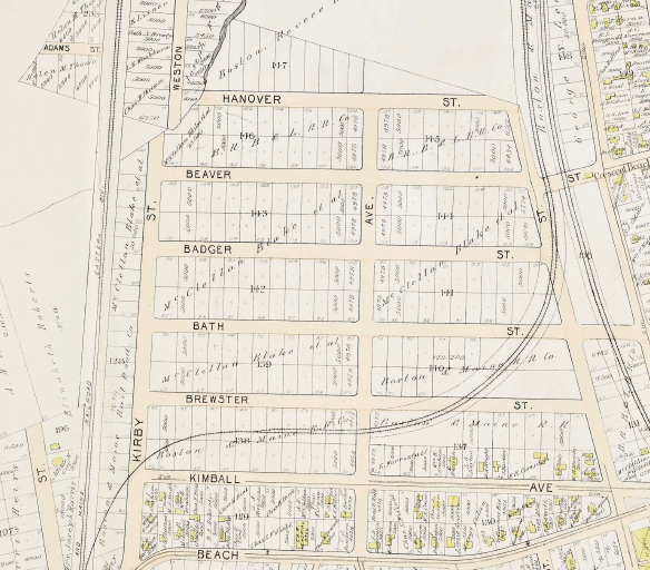
One reason the streets and blocks were never constructed is that most of that ground was marshland, and unsuited for construction unless built up with landfill or stabilized in some other way. To construct the buildings of Wonderland, they drove 60,000 spruce pilings into the ground. This gave them a firm foundation. In fact, the buildings of the present-day Wonderland Marketplace Mall are built precisely where the arc of Wonderland buildings from the Incubators to the Japanese Village were built, and sit atop the same pilings.
Another reason that the streets and blocks were not constructed is that the two sets of Boston and Maine Railroad tracks cut that section off from the rest of Revere. Even though the eastern loop (on the right in the above map section) wasn’t really an active train track (being used to store unused rolling stock), it still had to be crossed somehow, and there were no crossings. Wonderland got around this by building a bridge for each of their two entrances, both of the crossing that unused spur of track.
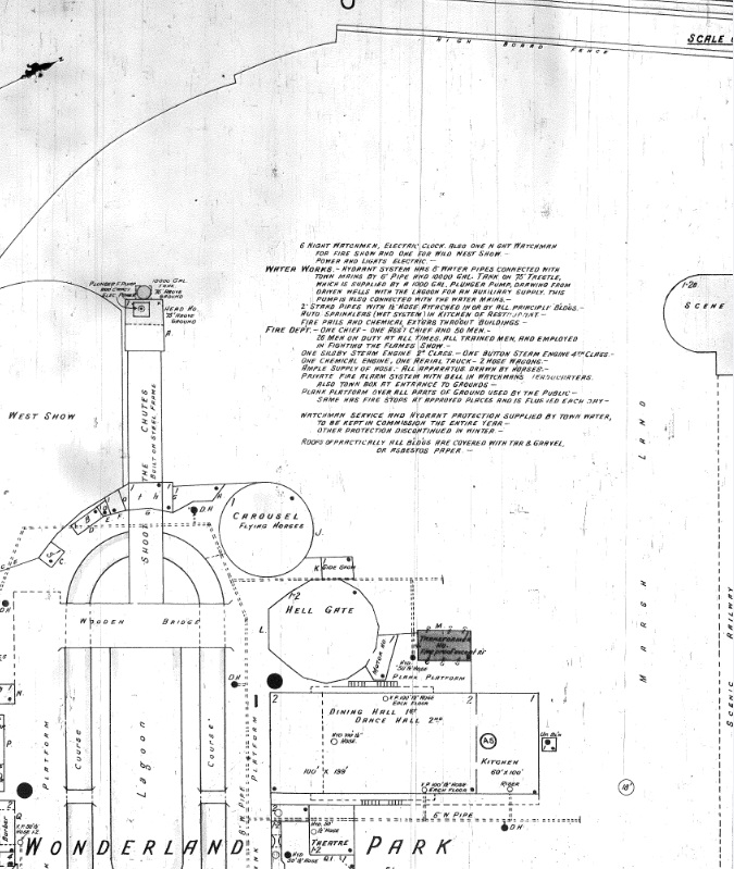
One of the few maps produced of Wonderland Park appeared in The Standard, a fire-insurance journal in its March 17, 1906 issue (North is at the top):
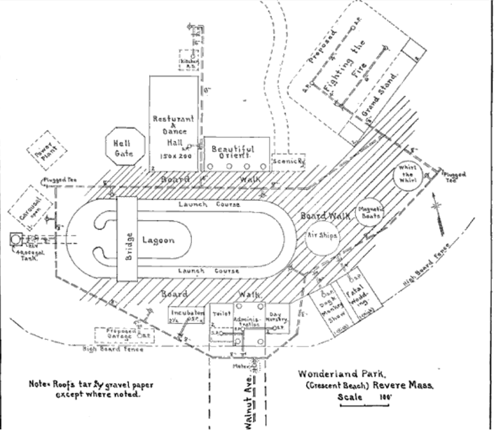
The map was made before the plans were finalized, so it’s not completely accurate. The Hell Gate is shown as a complete octagon, which it wasn’t — it only looked that way from the front. The Scenic Railway building was larger than shown. The Carousel building was round. The Whirl the Whirl was not off in the East, where it’s shown, but was actually built next to the Incubators. And there never was a “Magnetic Boats” ride (which isn’t even mentioned anywhere else). But in other respects the map is pretty much correct, especially in showing the boardwalk that was laid down between the buildings. The Boardwalk was set 2-3 feet above the ground level. It not only made taking care of the walking surface easier, it elevated it above the marshy ground.
The Howard and Whitman Fire Insurance Map was published too early to include details of Wonderland, so the buildings in Wonderland Park aren’t shown (Note: In this case, North is on the Right side):
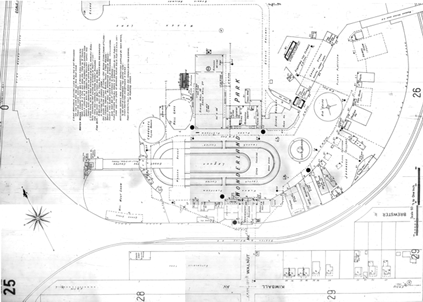
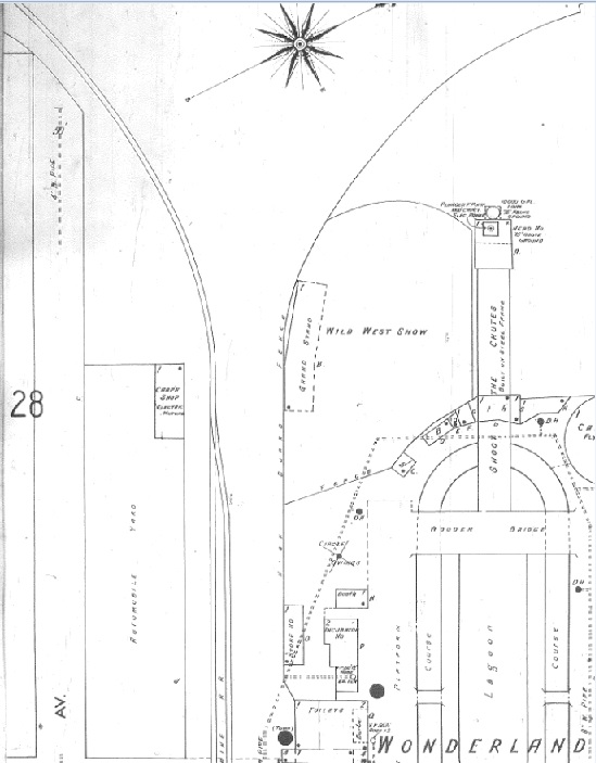
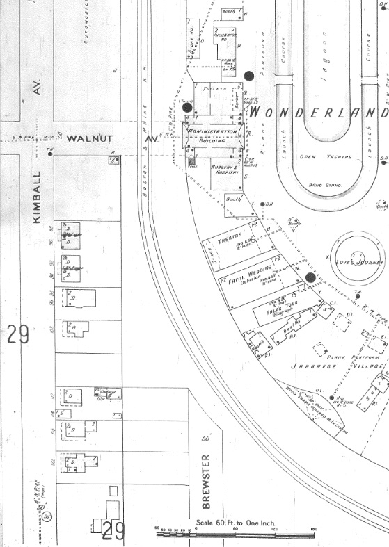
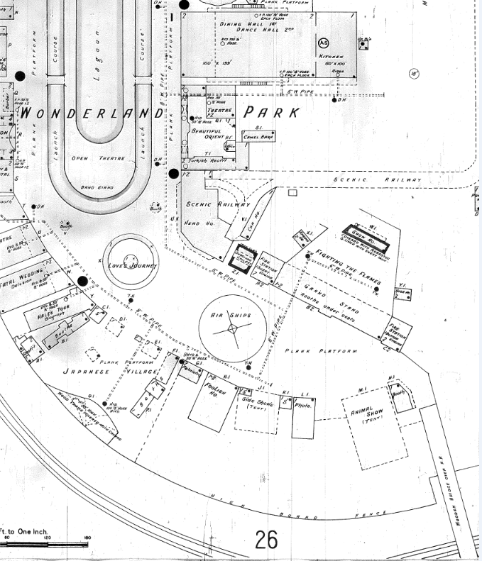
The 1906 Sanborn Fire Insurance Map, however, has all the details of the structures. We show it here in pieces so that you can see the details. Here’s the Southwest Corner (Note: In the Sanborn Maps, North is on the Right side):
Nest the Southeast Corner:
Here’s the Northwest Corner:
And the Northeast Corner:
Schematic Maps by Year
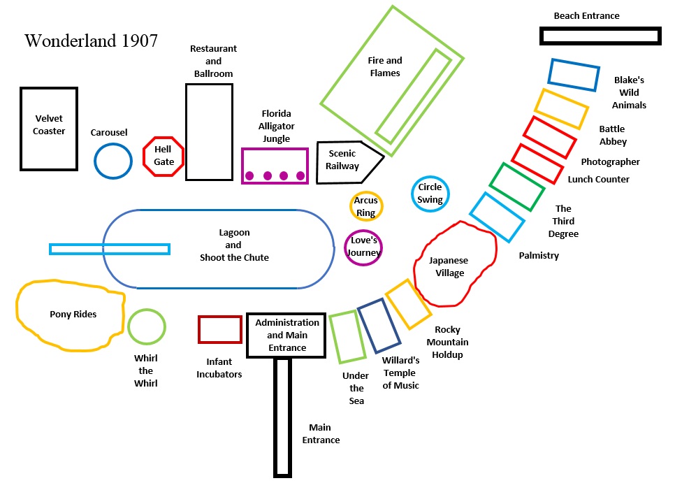
Wonderland wasn’t static. The maps above show the park as it existed only in its opening year, 1906. The attractions changed from year to year, as many of the pictures on this website show. The Shoot the Chutes, the Descent into the Hell Gate, The Ball Room and Restaurant, the Thompson Scenic Railway, and the Administration Building/Walnut Street Entrance stayed unchanged through the life of Wonderland, but the other attractions changed from year to year. In some cases I’ve been forced to guess where things were located, or what occupied a particular place. (Note: In all these maps, North is at the top)
1906
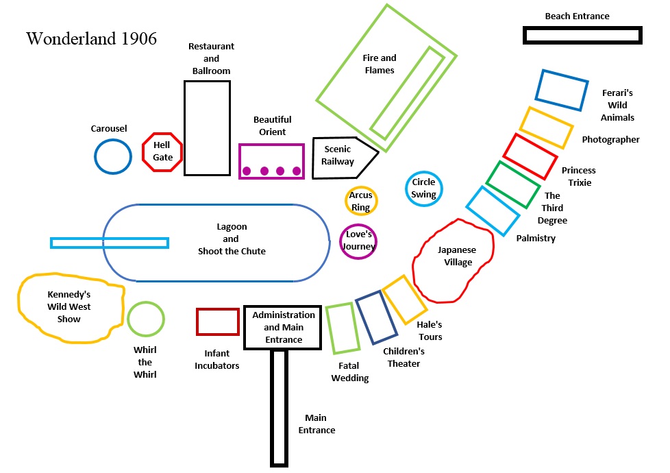
North is at the top, East to the right. The sketch is only meant to show where the attractions are relative to each other, and is not done to scale. (as you can see from the above scale map, the Palmistry building was much smaller than the Third Degree. There was also a lot more to the Beautiful Orient and the Scenic Railway, but this shows where the facades were located.) The Penny Arcade isn’t indicated here, but it lies between the Administration Building and the Fatal Wedding.
1907
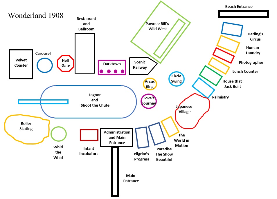
1908
1909
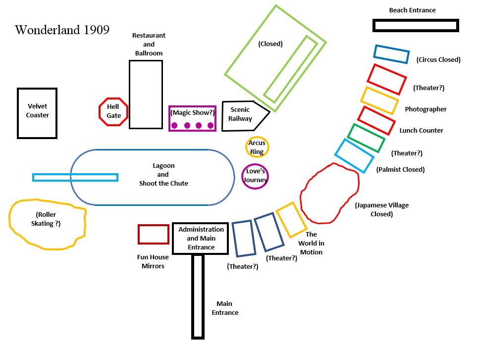
After the bankruptcy at the end of the 1908 season and the reorganization, the Park had to undergo some severe belt-tightening. The two attractions owned by Louis Bopp — The Carousel and the Whirl the Whirl — are no longer mentioned and I assume they were removed. Similarly, the Circle SWing is no longer mentioned either, and I think that the Japanese Village closed. The Infant Incubators were replaced by Fun House Mirrors, probably taken from the Third Degree/House that Jack Built. Nothing seems to have gone into the arena where Pawnee Bill’s Wild West Show had been. At least two new things were built, however — a kiddie carousel near the beach entrance and a stage for the musical show “Cinderella”
1910
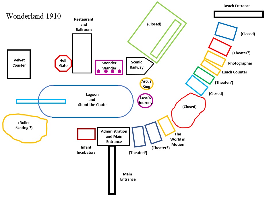
For the closing year a sort of playground for toddlers — the Wonder Wander — went in where the Beautiful Orient had originally been. The Infant Incubators were restored. In the place where Roller Skating is indicated above they displayed several models of airplanes and had the passenger balloon that could take one or two people aloft for a few minutes.
After Wonderland.
This map shows the area in 1914, after the Park had been closed for four years. I cannot identify the building shown. North is to the right
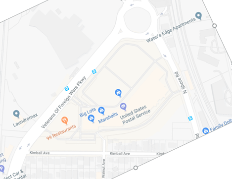
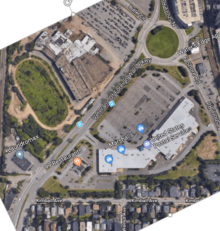
The images below show the 1906 Wonderland map with North at the top, followed by a modern map of the area at the same scale and orientation, followed by an aerial photograph of the area today. Most of the park is occupied by the Wonderland Marketplace Mall and its parking lot. Not that you can still see where the railroad spur ran, and that the Mall buildings occupy the same spaces as many of the Wonderland Park buildings. North of the big roads — Route 1A — is where Wonderland Greyhound Park was. About the only part of Wonderland Amusement Park that extended there is the LaMarcus A. Thompson Scenic Railway.